Only Logical delimitation can do justice in J&K
Only logical delimitation can undo injustice of past. In J&K delimitation exercise has never been conducted on provided parameters.

Only logical delimitation can undo injustice of past. In J&K delimitation exercise has never been conducted on provided parameters.
1.The Delimitation of single member assembly segments of the J&K Legislative Assembly as done since 1951 have been brutally unfair for the people living in the distant, backward, and remotely connected areas of J&K .The worst sufferers have been the people in and around the district of DODA ( Kishtwar, Ramban ), Udhampur ( Reasi) , Kathua , Rajouri and Poonch.
2.People of Kupwara and Baramulla too have a case of discrimination when compared with districts of small geographical compactness and better terrain in Kashmir Valley.
3. On May 1st 1951 a notification was issued as Proclamation No : 22 for instituting a Constituent Assembly. For this it was suggested through a notification that for constituting the Constituent Assembly the State of J&K was to be divided into Electoral Districts. Each Electoral District was to comprise a Segment of 40000 people ( subjects of J&K ).
4.Before Oct 1947 as per 1941 census ( provisional as laid in the Administrative Report of the Government of Maharaja of J&K 16-10-1940 to 15-101941 total population was 40,21,616 ) the population of Jammu Province was 20.01 Lakh , Kashmir was 17.29 Lakh and that of Gilgit / frontier Illakas of Skardu, Kargil & Ladakh was 3.12 Lakh. No Census was conducted in 1951 before deciding the Electoral Districts.Most of the POJKDPs 1947 had settled in Jammu region/ outside Kashmir Valley.
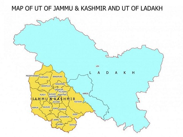
5. In 1941 Jammu Region comprised of 5 Districts – Jammu, Kathua, Udhampur, Reasi, Mirpur & 2 Jagirs of Punch and chenani , Kashmir region comprised of only 3 Districts- Anantnag, Baramulla, Muzaffrabad
6. In 1951-52 on adhoc basis population of whole J&K state was taken as app 400000 and just on that basis of population 100 seats for Constituent Assembly (CA) were decided. Out of which 75 seats were kept for areas of J&K that were not under occupation of Pakistan ( other than POJK) and as a result 43 seats fell in areas of Kashmir Valley , 30 seats in areas of Jammu Region and 2 in areas falling in Ladakh region.
7. Where as the population numbers had also much changed after 1941 census and after the disturbed conditions since Oct 1947. The manner in which the segments of Constituent assembly were distributed reveals that it was assumed that most of the population that was left in occupied areas under Pakistan belonged to Jammu Region which surely fails to any logical test.
8.Jammu Region had 6 District Administrative Units before 1979 and Kashmir Region had just 3 District administrative Units ( that were so unfairly made equal to Jammu Region i.e 6 in 1979 keeping that in Jammu Region only 6) and even before 1979 big correction could have been applied for increasing the MLAs in Jammu Region beyond 32 and decreasing that in Kashmir region below 42 but was not done. Even 1995 Delimitation Order was blind in this regard.
9.Wazir Commission had recommended for increasing the number of districts from 6 to 9 in Jammu Region . Where as for Kashmir Region Wazir Commission had recommended that districts be increased from 6 to only 7. This has been due to Kashmir region being geographically more compact as compared to Jammu Region.
10. But so unfairly in 2006 the then Congress- PDP Government gave kashmir region 300 % more than what was recommended by Wazir Commission i.e 6 to 10 instead of 7 districts and only 33% more to Jammu region i.e 6 to 10 instead of 9 than what was recommended by Wazir commission.
11.Geographical Compactness: Jammu region is much less compact than Kashmir region: Nature of terrain : The terrain of areas in Doda , Kishtwar, Udhampur, Reasi, Kishtwar, Ramban, Kathua, Rajouri and even some parts of Samba District is bad and difficult as compared to most of the areas in Kashmir region.
12.Facilities of Communication : The surface transport infrastructure in Jammu region is at much lower level as compared to Kashmir region. Hence it is more difficult for a MLA of these areas to visit his people or for people to visit him. Surely more MLAs are needed.
13. Area in Jammu region is 26293 Sq.Km but in kashmir region area is 15948 sq.km
Road network in Jammu region is 10469 km but road network in Kashmir region is 13367 km
Plain area in Jammu region is 4293 sq.km but in kashmir region is 7526 sq.km
Hilly area in Jammu region is 17992 sq.km but in kashmir region it is 4948 sq.km.
14. In 1996 Gurez was made a constituency with just 9900 voters but smallest constituency in Jammu region was Bani with 27000 voters. Nawapachi in Kishtwar having only air connectivity in winters with 18000 voters is not a constituency. Difference itself can be seen.
DISCLAIMER: The author is solely responsible for the views expressed in this article. The author carries the responsibility for citing and/or licensing of images utilized within the text.