Why we are kept away from the truth
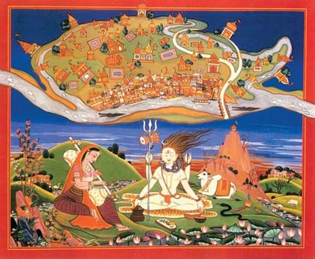

Traditional Hindu Maps:
“Indians had no knowledge of cartography before maps were introduced by Europeans”
– said India’s first prime Minister Jawaharlal Nehru.
He was wrong. Here is a traditional map of Varanasi made by Hindus in 17th century.
This painting depicts Lord Shiva and Goddess Parvati with Nandi in the background.
Standing on Shiva’s trident is the Holy city of Varanasi. It is surrounded by river Varana in the north, river Asi in the South and river Ganga in the east. In the north is depicted the temple of Omkareshvara and in the South is the temple of Kedareshvara. Manikarneshvara, Sangameshvara, Madhyameshvara are also shown. Map also depicts the ghats of Varanasi. In this map primarily meant for pilgrims, civilian area and crematorium is also shown.
At the center of Varanasi was the most important Kashi Vishveshvara temple (destroyed by Aurangzeb and replaced by Gyanvapi mosque in 1669)
Har Har Mahadev
DISCLAIMER: The author is solely responsible for the views expressed in this article. The author carries the responsibility for citing and/or licensing of images utilized within the text.